Satellite intelligence for every farm
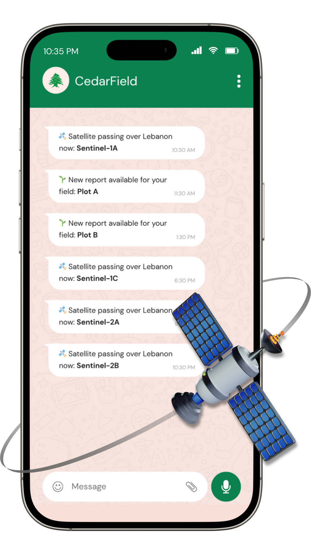
CedarField processes multi-spectral satellite imagery every 5 days to deliver actionable crop health, water stress, and yield insights — direct to your WhatsApp or web portal.
Trusted by Lebanese farmers across the Bekaa Valley and South Lebanon.
From orbit to every farm.
CedarField processes ESA Sentinel-2 and NASA MODIS satellite imagery every five days to monitor crop health, detect water stress, and forecast seasonal performance — bringing geospatial intelligence to every field in Lebanon and beyond.


How CedarField delivers intelligence

Crop Health Monitoring
Track NDVI, EVI, and LAI indices from Sentinel-2 imagery updated every 5 days. Detect stress, disease risk, and growth anomalies field by field before they become yield losses.

Water Stress & Irrigation
NDWI and thermal band analysis identifies water-stressed zones across your fields. Get targeted irrigation recommendations that reduce water use while protecting yield.

Seasonal Performance Reports
End-of-season summaries combine multi-temporal satellite data with ERA5 weather records to benchmark yield performance and inform next season's crop planning.
CedarField turns raw satellite imagery into actionable field intelligence in four steps.
From satellite to your phone
Map Your Fields
Draw your field boundaries on our web portal. We register your fields and activate satellite monitoring within 24 hours.
Satellite Imagery
Every 5 days, ESA Sentinel-2 captures multi-spectral imagery of your registered fields at 10-meter resolution.
AI Analysis
Our algorithms compute NDVI, NDWI, EVI, and LAI indices to detect crop stress, water deficits, and growth anomalies.
Alerts & Reports
Actionable insights arrive on your WhatsApp or web portal within hours of each satellite pass — in Arabic or English.
Free Plan
For independent and family-owned small farms
Free
Forever
- 1 field, up to 2 hectares total
- NDVI health status updates every 5 days
- Water stress indicator (NDWI)
- WhatsApp alert integration
Growth Plan
PopularFor medium-sized privately owned commercial farms
$99/year
Free for 12 Months
- Unlimited fields, up to 10 hectares total
- Single field capped at 10 hectares
- Full index library: NDVI, EVI, NDWI, SAVI, LAI, NDRE
- Irrigation scheduling recommendations
- Yield proxy estimates per field
Enterprise Plan
For agricultural corporations and large cooperatives
$49/Hectare/year
Minimum $499/year
- Unlimited fields, unlimited total area
- Required when total area exceeds 10 hectares
- Minimum 10 hectares required
- Everything in Growth Plan, plus:
- Multi-user access with role-based permissions

FAQs.

Start monitoring your fields today
Join Lebanon's first satellite farm monitoring network. Apply for pilot access and start receiving field intelligence in your next growing season.